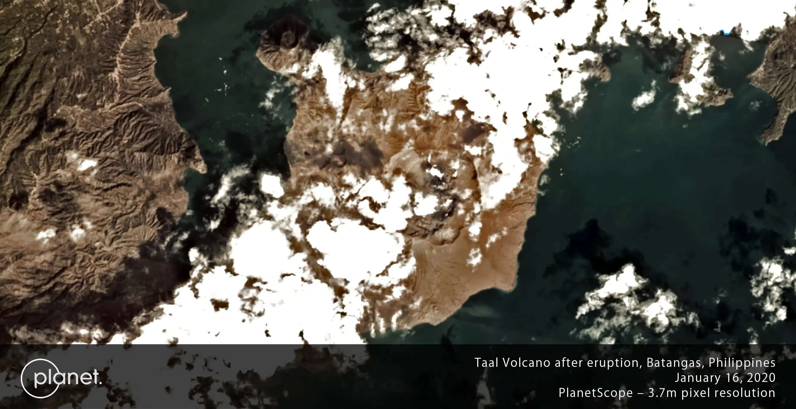
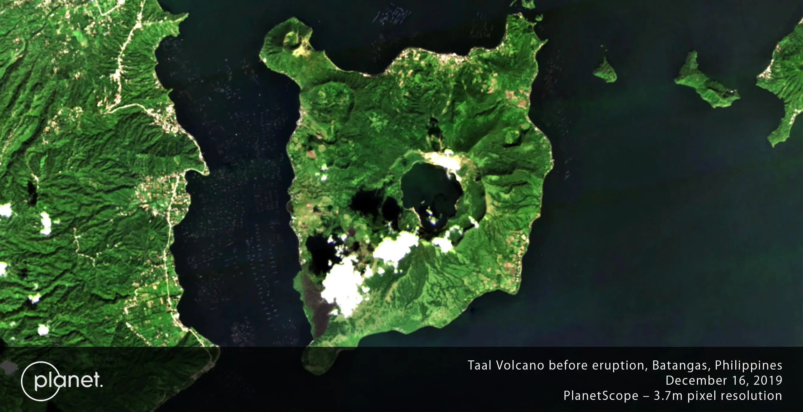
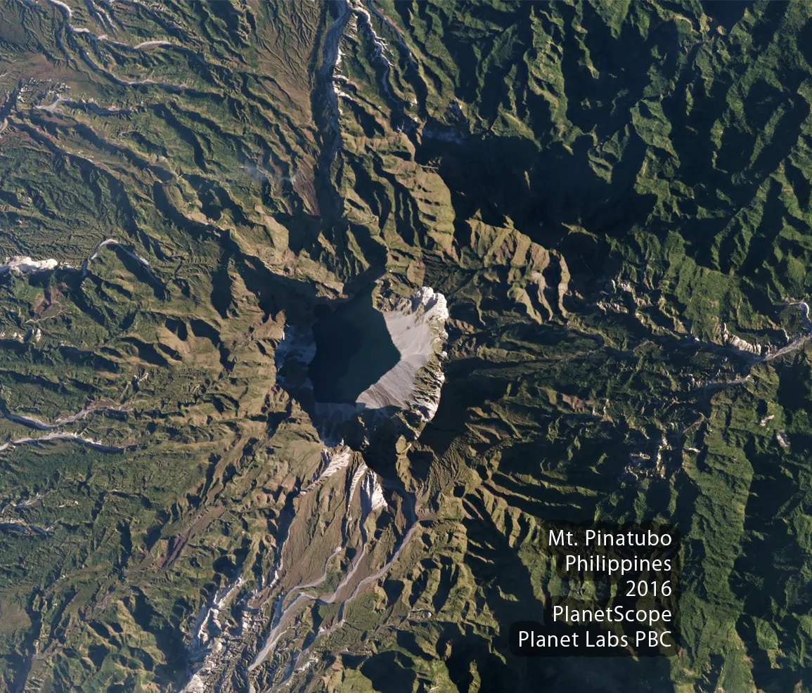
 Optical Satellite Imagery
 Non-optical Satellite
Imagery
Non-optical Satellite
Imagery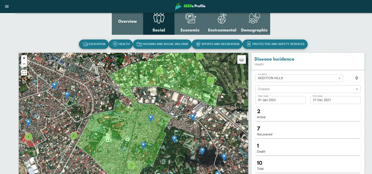 Analytics Services and
Software
Analytics Services and
Software OUR CLIENTS :


MEMBER OF: